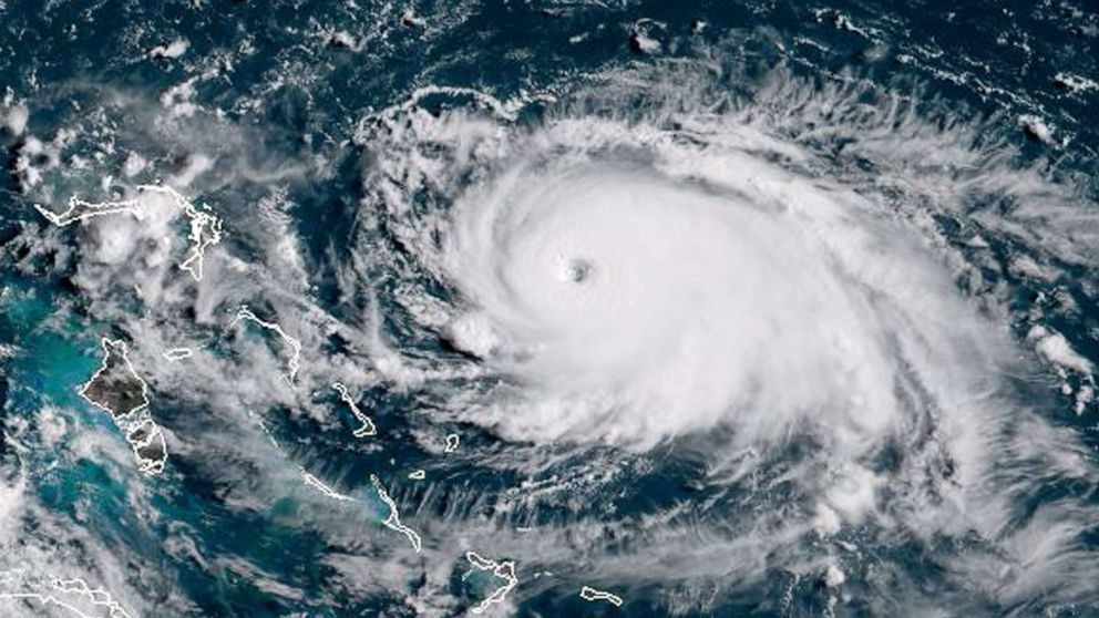
In nine hours, Hurricane Dorian’s peak winds increased from 150 mph (130 knots) to 185 mph (160 knots). It was a rate of intensification that’s never been seen before.
The Category 5 storm that devastated portions of the Bahamas underwent what’s referred to as rapid intensification. The National Hurricane Center of the National Oceanic and Atmospheric Administration (NOAA) states that rapid intensification is an increase in maximum sustained winds of a tropical cyclone of at least 35 mph (30 knots) in 24 hours.
Serving as the warning coordination meteorologist for the National Weather Service in Key West is Jon Rizzo. With rapid intensification come real dangers, he said, especially when storms intensify as they approach a coastline. The Labor Day Hurricane of 1935 is one example.
“You run the risk where someone’s going to hear the news before they go to bed of a new tropical storm or category 1 hurricane,” he said. “Then they wake up eight to 10 hours later and you have a category 3 at your doorstep.”
A number of ingredients need to be in place for rapid intensification to occur. Rizzo said some of the big ones include warm water temperatures, near or above 86 degrees. The water has to be sufficiently deep, so it has to be down in the ocean at least 200 to 300 feet.
There also need to be low vertical shear winds. Rizzo said high shear winds rip the tops off a developing hurricane, which leads to weakening. High pressure and the presence of thunderstorms 50,000 to 60,000 feet high also factor in.
“Throughout the season, these ingredients are not all present at the same time,” Rizzo said. “It’s not at all that common that these conditions occur, or it may occur in a small part of a tropical storm’s lifetime. It’s just that the busier season with a lot of storm numbers tends to have chances in place. The season with 15 to 30 storms in a year, you tend to see a major one.”
NOAA’s Climate Prediction Center is forecasting a likely range of 13 to 19 named storms, of which six to 10 could become hurricanes and three to six major hurricanes.
The combination of several climate factors is driving a strong likelihood for above-normal activity in the Atlantic this year. El Niño conditions are expected to remain neutral or trend toward La Niña, meaning there will not be an El Niño to suppress hurricane activity.
“We always have to keep in mind where we live in Florida and the presence of warm water,” Rizzo said. “That’s why we need to leave when directed to do so and instantly have that plan to leave, and make sure there’s a plan B for aggressive evacuation.”


