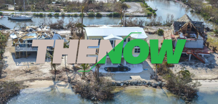
With more storms brewing in the Atlantic, the last thing locals want or need is an exhaustive account of last year’s natural disaster. With that in mind, the Weekly Newspaper is hitting the high points — the eight things you need to know about Hurricane Irma, and some visual reminders of what it looked like right after the storm as compared to now. GFY Irma.
[twenty20 img1=”23571″ img2=”23572″ offset=”0.1″]The Sea Breeze Trailer Park, at MM 87 in Islamorada, was one of the hardest hit areas of the Upper Keys. Of the nearly 40,000 homes in the Keys affected by the storm, 1,179 were destroyed.
[twenty20 img1=”23573″ img2=”23574″ offset=”0.1″]
Rowell’s Waterfront Park in Key Largo was used as a staging area for hurricane debris after Irma. It’s been announced that it will once again be put to use to stage debris hauled out of canals.
[twenty20 img1=”23568″ img2=”23567″ offset=”0.1″]
The City of Marathon Marina and Boot Key Harbor took a beating during Hurricane Irma and staff has worked incredibly hard to put it back together.
[twenty20 img1=”23556″ img2=”23557″ offset=”0.1″]
The hurricane-driven sand almost covered the tops of the picnic tables at Sombrero Beach in Marathon. FEMA recently approved a plan to restore the beach to what it was, but the City of Marathon must wait until it has the $1.4 million in the bank.
[twenty20 img1=”23555″ img2=”23554″ offset=”0.1″]
Both of these oceanfront homes near 85th Street in Marathon were completely blown out. The one in the foreground looks livable again.
[twenty20 img1=”23558″ img2=”23577″ offset=”0.1″]
The boats were blown from east to west and stacked up along the Boot Key Bridge in the Middle Keys. A trio of agencies were responsible for removing the navigation hazards.
[twenty20 img1=”23566″ img2=”23565″ offset=”0.1″]
The canal between 96th and 97th streets in Marathon was choked with debris. Some of the debris floated out on the tide, some sank to the bottom, and more is being systematically removed by contracted professionals.
[twenty20 img1=”23560″ img2=”23559″ offset=”0.1″]
The canal between Avenues I and J on Big Pine Key is one of roughly 100 heavily impacted canals still full of debris, but it’s being cleaned by Adventure Environmental through a federal grant.
[twenty20 img1=”23562″ img2=”23561″ offset=”0.1″]
The top level of the Thomans’ three-story storage building toppled over onto the first level after the middle blew out during Irma. Their boat, an Island Hopper named Little Suzie II, rose up out of the canal where it was docked and floated about 50 yards away to a neighbor’s yard.
[twenty20 img1=”23564″ img2=”23563″ offset=”0.1″]
Insulation, sheetrock and other debris fill the side yard of Joan and George Thoman’s Avenue I home on Big Pine Key. It took months and plenty of volunteer help to clear the property, after which the home, along with another house, was leveled. The Thomans plan on rebuilding both.
[twenty20 img1=”23570″ img2=”23569″ offset=”0.1″]
This Ramrod home, which is one lot removed from the open water, is in the process of being repaired. The homeowners also righted the palm tree.
[twenty20 img1=”23551″ img2=”23550″ offset=”0.1″]
Lots of big, very old banyan trees fell in Old Town, this one on Margaret Street just missing the house. The house and street have been restored to mint condition.
[twenty20 img1=”23549″ img2=”23548″ offset=”0.1″]
Applerouth Lane, home to Mary Ellen’s Bar, was impassable after Hurricane Irma. Now, it’s back to business as usual.
[twenty20 img1=”23553″ img2=”23552″ offset=”0.1″]
