Early Spanish charts identify the island as Matecumbe la Vieja. The 1774 Romans chart called it Vieja Matacomb. The following year, on Gauld’s 1775 chart, the name was translated into English as “Old Matecumbe.”
In the Upper Keys, Lower Mat, as the locals call it, was the last island to become home to its first permanent residents. According to the 1870 census, the population of the Upper Keys was: Key Largo, 61; Plantation Key, 9; Windley Key, 4; Upper Matecumbe Key, 13; and Indian Key, 46. Lower Matecumbe registered a population of zero.
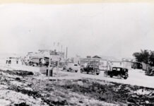
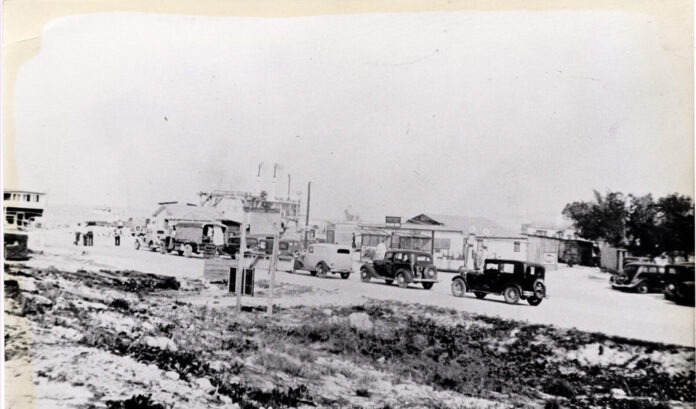
More than six decades later, in late 1934 and early 1935, hundreds of people were brought to the Keys to fix a problem. When the first version of the Overseas Highway, officially designated State Road 4A, opened to traffic in 1928, it was incomplete. The road ended at the west (south) end of Lower Mat and did not resume until No Name Key, 40 miles away. The gap was bridged by automobile ferries.
Workers, many of them World War I veterans, were brought in to build a series of automobile bridges between Lower Mat and Big Pine Key. To house them, three camps were constructed in the Upper Keys. Camp 1 was built on Windley Key. Camps 3 and 5 were constructed on Lower Matecumbe Key — Camps 2 and 4 were located outside of the Keys, in St. Petersburg and Clearwater. Camp 3 was located at the west (south) end of the island. At the east (or north) end of Lower Mat Key was Camp 5.
It is this end of the island, the east end, that connects to Upper Matecumbe by bridges and railroad fill. The east end of the island, too, became home to the Starcks, the island’s first permanent residents. They arrived in 1946.
Walter “Buck” Starck grew up near S.W. 7th Street and 10th Avenue in Southwest Miami, where his father, also named Walter Starck, worked as a charter fishing captain from the helm of his fishing cruiser Norma II. The elder Starck operated his charter boat out of the Royal Palm docks in Miami, but fished his clients in the waters surrounding Cuba, the Bahamas and the Florida Keys. In the 1920s and early 1930s, he docked the Norma II at the famed Long Key Fishing Camp.
Buck Starck grew up on the water, fishing with his father. Because of his love of the ocean and his aptitude for math, a retired master of celestial navigation began tutoring him. By age 21, Starck had passed all the tests necessary to become certified as a master mariner. At the time, he was the youngest person with that distinction in the country.
In 1937, Buck married Ruth Shires. The same year, he and his father purchased the Whale Harbor Fishing Camp on the east (north) end of Upper Matecumbe Key. When World War II erupted, Buck volunteered and served with the Navy for three years. After the war, the Starcks sold the Upper Matecumbe fishing camp and bought 17 acres on Lower Mat. They transported an old Key lime packing house to the property and used it as a base of operations while building homes for Buck and Ruth, as well as Buck’s father, Walter.
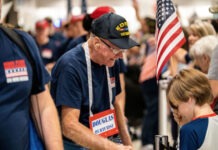
By Christmas, they had moved into their new homes, where they raised two boys, Walter and Terry, and ran the Starck Fishing Camp. Though the boys grew up and moved away, Buck and Ruth lived at their Lower Matecumbe home for the rest of their lives. In 2010, they passed away within days of each other. Their lives were celebrated on Nov. 29, what would have been their 73rd wedding anniversary.
The old Stark Fishing Camp is now home to one of the island chain’s great roadside attractions, Robbie’s of Islamorada. Robbie Reckwerdt established the marina in 1976; it has been a legend ever since. As a local attraction, it started when Robbie found a young tarpon struggling in the mangroves. After he scooped it up in a net, he dumped the fish in a bait tank and called in reinforcements.
The fish’s jaw had been torn loose. Doc Roach arrived with twine and his wife’s knitting needles. He stitched the jaw up, and the fish recovered in the bait tank for several months before Scarface, as the fish was named, was set free. Scarface never went far, stuck around for the free food and let all his tarpon buddies in on the secret.
People have been visiting the marina and hand-feeding the tarpon schooling beneath the docks for decades. It is the reason why the marina’s restaurant is called the Hungry Tarpon. Go to feed the tarpon, stay for the backcountry and offshore fishing, snorkeling, eco-tours, the glass-bottom boat Transparensea (check out the moonlight cruise out over the reef), kayaking (mangrove tours and Indian Key), boat rentals, wave runner tours, shopping, rumrunners — it is the No. 1 destination in the Keys for a reason.
After passing Robbie’s, Lower Mat is home to at least two beaches. In the Keys, beaches do not always refer to sandy, oceanfront expanses. Sea Oats Beach is on the left. “Beach” will not immediately jump to mind. In a past life, locals called it Bale Beach because of the bales of marijuana that used to wash up.
The sea oats have all but disappeared, and there isn’t much “beach” left, but it is a great place to stroll the ocean’s edge while looking for the treasured seed pods called sea beans that float across the ocean and wash ashore with the tide. There is no parking. However, moving on down the highway, right before the island ends, is a left and right turn option. The left delivers you to Anne’s Beach and a convenient parking lot. It is an excellent destination to get your feet wet, have lunch in one of the covered picnic pavilions and stroll along the raised wooden boardwalk. While Anne’s Beach excels in natural beauty, bring bug spray. For kiteboarders, this is a great local spot to let your kite fly on windy days.
Just after Anne’s Beach, a right turn leads to a parking lot at the foot of the Channel Two Bridge. From there, you can take a walk down the old railroad bridge, enjoy the breeze, and do a little bridge fishing.
