There is talk about building a new Seven Mile Bridge to replace the old Seven Mile Bridge, which replaced the original Seven Mile Bridge. Between road projects and the water pipeline, a simple drive down the Overseas Highway provides clear evidence that the infrastructure supporting our Florida Keys communities is aging.
Building a new conduit to bridge the sevenish-mile gap between the Middle Keys and Lower Keys would be a massive undertaking, and the cost would be substantial. It is likely that the job will not be just about bridge building but will also involve the lone conduit delivering freshwater to the Lower Keys. The current pipeline travels beneath the modern Seven Mile Bridge, and rerouting it to accommodate a new Seven Mile Bridge will cost some serious coin.
The pipeline did not begin delivering water to the island chain until 1942, with the first drops arriving in Key West on Sept. 22. It traveled then, as it does today (with a few exceptions), along the right-of-way established by the Florida East Coast Railway. Of course, there are one or two places where the modern highway has diverted from the old railroad line.
The Bahia Honda bridges are one example. Henry Flagler’s train chugged along the path of the park’s road, past Loggerhead Beach and through that magnificent old camelback bridge. For decades, the Overseas Highway traveled along the same path — except that it traveled up and over the bridge, 65 feet above the sparkling waters of the pass! The modern highway route across Bahia Honda that skirts the park and delivers breathtaking views of the railroad bridge opened in 1972.
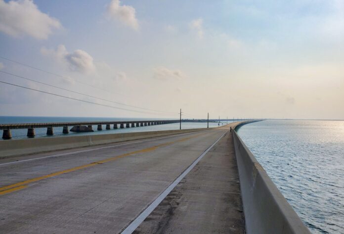
The Seven Mile Bridge is another section of the railroad that veered significantly from the modern Overseas Highway’s route: the original bridge incorporated four distinct sections, plus the Moser Channel Swing Bridge. The first three bridge spans, Knights Key (6,803 feet), Pigeon Key (5,935 feet), and Moser Channel (13,947 feet), were built using concrete piers reinforced with three-quarter-inch steel rods. Steel girders, weighing more than 40 tons each and measuring 80 feet long, were lowered across the piers to create the foundation on which the railroad tracks were later attached.
The fourth section, the Pacet Channel Viaduct (9,035 feet), used a different design, a series of concrete arches to support the tracks — hence, its distinction as a viaduct. When the length of each of the four spans is tallied together, they come up a little short of seven miles.
It takes 36,960 feet to stretch seven miles. The combined footage of the four railroad bridges is 35,720, making for a 1,240-foot shortfall.
Once, there was a plan to build an automobile bridge that roughly paralleled the not-quite-seven-mile railroad spans. When the first Overseas Highway opened to traffic in 1928, it was incomplete. While driving from the mainland to Key West was possible, there was a 40-mile gap between Lower Matecumbe Key and No Name Key. Reaching the Lower Keys from the Upper Keys required a four-hour trip aboard an automobile ferry.
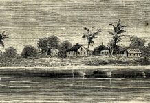
The plan to build the automobile bridges to eradicate the need for a ferry system never fully came to fruition. The project’s workforce began to arrive in November 1934; many were World War I veterans. Three work camps were built to house the men, each capable of accommodating about 250 people. The first major bridge project that was undertaken was linking Lower Matecumbe to Fiesta Key (called Jewfish Bush Key in those days). Evidence of the effort to construct the bridge still stands in the shallow waters in the form of eight cement bridge piers.
And then, on Sept. 2, 1935, the eye of the Category 5 Labor Day Hurricane crossed Lower Matecumbe Key and Long Key. The seminal Florida Keys event took hundreds of lives. The killer hurricane also destroyed 40 miles of railroad tracks, and Flagler’s train never ran again. Had the hurricane not struck the Keys on Sept. 2, the bridge projects would have been completed, and it is pretty likely that there would already be three “Seven Mile Bridges” standing in the shallows between Marathon and the Lower Keys.
As a result of the devastation and the end of the railroad, the decision was made to abandon the bridge-building projects. While 40 miles of railroad tracks were destroyed in the storm, Flagler’s bridges withstood the fury of the Category 4 hurricane. As a result, the Florida East Coast Railway sold its right-of-way to the state for $640,000. Rather than build a new series of bridges, the decision was made to convert the standing railroad bridges to accommodate automobile traffic. The new and improved Overseas Highway that incorporated the old railroad bridges (and widened them to accommodate cars, trucks and buses) opened to traffic in 1938.
It was not until 1982 that we started driving along the modern Seven Mile Bridge, marveling (still) at the vistas, and now saying hello to Fred the Tree inexplicably thriving on the remains of the Pacet Channel Viaduct. The modern bridge measures a reported 6.79 miles or 35,851 feet – still a little short of the seven-mile mark. Perhaps, if they build a new Seven Mile Bridge, they will find a way to tack on the extra 1,110 feet to make it an actual Seven Mile Bridge.


