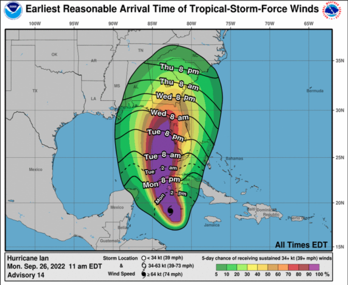
Monroe County offices and Keys schools will close on Tuesday as tropical storm conditions are expected with Hurricane Ian passing roughly 65 miles west of Dry Tortugas. City of Key West and Village of Islamorada offices will also be closed Tuesday.
County, city and school officials will decide tomorrow whether those offices and schools will remain closed for Wednesday.
A tropical storm warning remains in effect for the Lower Keys from the west end of the 7-Mile Bridge through the Dry Tortugas. Earlier on Monday, a tropical storm watch was added for the Middle Keys from the 7-Mile Bridge to Channel 5 bridge.
Areas from Big Pine Key and west could see stronger tropical storm force gusts of 60-70 mph Tuesday afternoon into Wednesday. There’s also a chance for 50-60 mph gusts within a few squall lines further up the Keys.
“If the storm gets larger or there’s a modest nudge of the track further east, then the big impact of tropical storm conditions could get into Marathon and areas up through Layton,” Rizzo said.
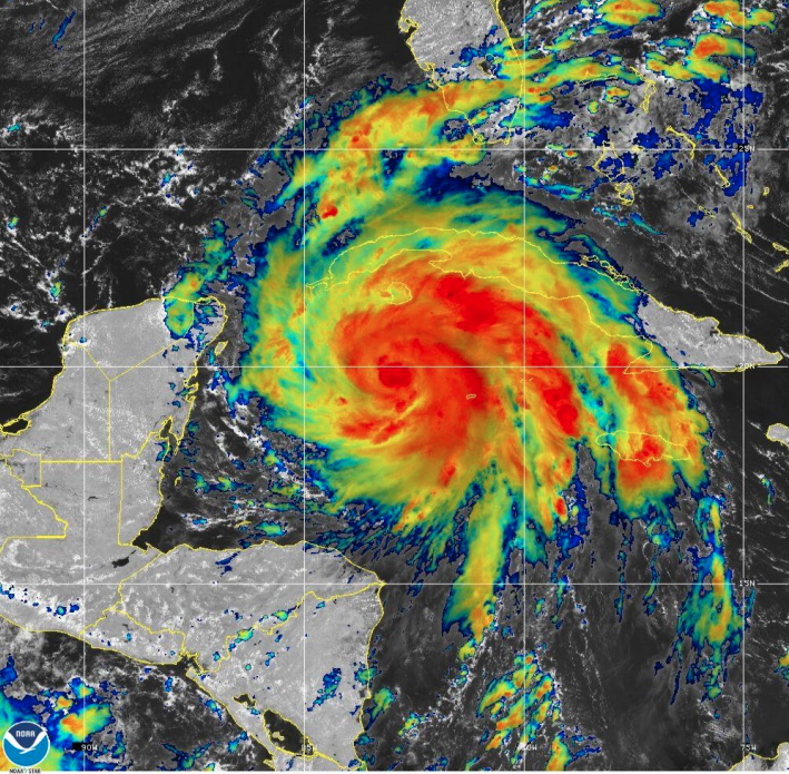
A storm surge watch that remains in effect for the Florida Keys could be upgraded to a warning. Rizzo said storm surge flooding could exceed 1-3 feet above normal high tides. Rizzo said there’s a “pretty good king tide” going on right now that’s roughly 1 foot above normal high tide. The highest storm surge will likely occur Wednesday, after the center of Ian passes west of the Keys on Tuesday night, Rizzo said.
“For areas very vulnerable to flooding and king tide — I would specifically add the gulf side of the Florida Keys — plan for waters to get possibly as high as 2 feet above what you’re seeing now,” he said. “I’m more concerned about Wednesday as the storm starts to climb over the shallower waters of the eastern gulf of Mexico. That’s when we’ll see the highest water on the gulfside, northside of the islands of the Lower Keys.
“As Ian continues off to the north and northeast, getting close to and possibly affecting central Florida, winds will start to go southwest and drive that water into the eastern parts of Florida Bay. My concern is that those maximum storm surge effects in the Upper Keys on the bayside could possibly not peak until Thursday and then linger through Friday. Once that water gets in there it may take a long time for it to drain out.”
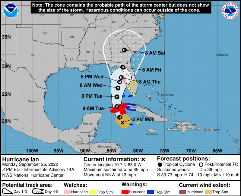
Otherwise, Rizzo said nothing’s changed in the forecast. Ian is intensifying and will have another chance to strengthen rapidly for the next day or so. It is expected to become a major hurricane Monday night as it approaches Cuba. The core of the storm will remain well west of Dry Tortugas and head north, northeast at a slower pace.
Rizzo said rainfall now through Thursday will range from 4-8 inches. Threats of a tornado remain as squalls pass beginning late Monday through Wednesday.
“Most of your preparedness actions should be completed by late this evening,” Rizzo said.
County Commissioner Jim Scholl reiterated concerns from Key West officials, who have repeatedly asked that an onshore shelter for liveaboards be opened. Scholl said Key West recently saw two fatalities with people commuting in their dinghies. And that was without tropical storm warnings and without declared emergencies, he said.
“I know there’s some limited capacity ashore for those who have friends and things, but not enough,” he said. “Obviously, hotels haven’t evacuated, so that capacity isn’t there. And of course they would want to charge money. I know there’s some concern and I’ve had questions about having a shelter ashore for liveaboards so that they don’t have to go through that channel out there — which is the roughest one in the Florida Keys — and risk their lives going back and forth to work.”
Shannon Weiner, county emergency management director, said they decided not open any county general population shelters at this time. She said it’s an operating procedure that shelters don’t open during a tropical storm.
“We do base things on our threat level. I understand you see a need there or a possibility for a need. We have been monitoring. We always monitor shetler demand, take questions from the public and try to assist where we can, and we have not seen the demand for shelters,” she said.
When open, Weiner said general population shelters don’t usually see many people from the liveaboard population.
“They do tend to be very mindful and have a solution of their own,” she said. “Nothing has changed as far as Coast Guard operation procedures. While they do ask there be no movement in the port after 8 p.m., that doesn’t mean that they are prohibited. They won’t ask them to leave or move. They just like to keep the port to a minimum for safety purposes.”
Scholl said he wasn’t asking for a general population shelter but consideration for the “very high-risk portion of the population at the end of the county that will have the biggest impacts from the storm.” Weiner said they’ll take that into consideration and will discuss the matter with Key West officials.
“If there’s a decision tomorrow morning it will be too late. We need it this afternoon,” Scholl said.
Key West city officials told the Keys Weekly after the countywide call Monday afternoon that discussions were indeed taking place about a shelter option for liveaboards. Stay tuned to keysweekly.com for more updates.


