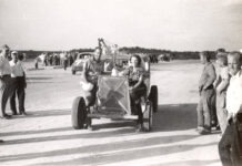
There are 1,000 origin stories behind the names given to the Florida keys, and countless people have contributed to them. One of those was Charles Brookfield. He was born in 1903 in Philadelphia. At 21, he ventured to Miami and immersed himself in the history of South Florida and the Keys. In 1926, Brookfield built a boat designed to navigate the local reefs, shoals and seagrass shallows. He named the 26-foot vessel with a draw of 26 inches Manatee.
The following year, in 1927, the U.S. Coast and Geodetic Survey hired Brookfield (and his boat) to assist on a survey that would update the government’s outdated nautical charts. The project took several years, and, as a result, Brookfield had a hand in the naming of, among others, the Bob Allen, Bottlepoint, Bradley, Calusa and Manatee keys.
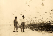
Why did he choose those names? Bob Allen was an Audubon hero who helped save the whooping crane from extinction. After moving with his young family to Tavernier in 1939, Allen studied the endangered roseate spoonbill and, when spying on them, camped out on an island that kind of looked like a bottle, hence the name Bottlepoint Key.
Bradley Key, located about one mile west-southwest of Flamingo (an Everglades outpost at the edge of Florida Bay), was named in honor of Guy Bradley, who was hired as a wildlife officer to enforce laws against plume hunting in the Everglades. Those hunters murdered him on July 8, 1905. Calusa Key, found eight miles due north of Lignumvitae Key, was not named for some ancient tribal reason but simply to honor the Calusa people.
The Manatee Keys are found about seven miles north of Snake Creek, the pass separating Plantation and Windley keys. Snake Creek is also home to the last of the Overseas Highway’s drawbridges. Fortunately, it is only raised at the top of every hour, so delays, though inconvenient, are not just some random occurrence. The Manatee Keys were not named for the Sunshine State’s loveable sea cows but after Brookfield’s vessel, Manatee.
In the northernmost keys is an island recorded on Spanish charts as Las Tetas. Found in Biscayne Bay, the island is located between Elliott and Boca Chita keys. A 1743 chart identifies it as Restinga de las Tetas which, in English, basically translates to something along the lines of “coastal forest of the tits.” William Roberts’ 1763 “First Discovery and Natural History of Florida” used the simplified moniker Las Tetas.
The cartographer Bernard Romans confirmed the island was called Las Tetas (and also The Paps) on his 1774 chart. Romans noted that there were two hills on the island. Because hills are not a common feature associated with the hundreds of islands making up the archipelago, the “hills” were probably mounds associated with a former aboriginal presence. In J.W. Norie’s “Piloting Directions for the Gulf of Florida, Bahama Banks, & Islands,” published in 1828, he noted: “Next to the northward of Elliot’s Kay is a little island, having two small hills on it, whence the Spaniards have called it Las Tetas, or The Paps.” Today, the island is known as Sands Key.
There is an island in the Upper Keys located west of Tavernier Creek that was officially named rather late on the local history timeline. In 1992, the island was named Kalteux Key after Tavernier’s Franklin James Kalteux (1900-1983), who moved to the area in 1951. Kalteux, nicknamed “Mr. Tavernier,” worked to develop Plantation Yacht Harbor Resort and the Tropical Atlantic Shores subdivision. In 1992, the U.S. Board on Geographic Names, with a push from Florida Senator Bob Graham and Mr. Kalteux’s stepson, Jerald Lee O’Cathey, officially named the island Kalteux Key in his honor.
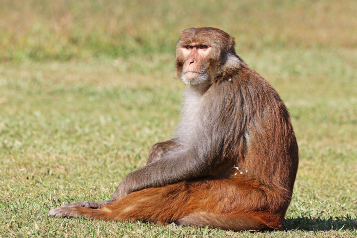
A little farther down the island chain, one of the more talked-about outer keys, and one that was connected by neither Flagler’s Over-Sea Railroad nor the Overseas Highway, used to be called Cayo Cagumas. At least that was what it was called on early Spanish charts. “Cagumas” is a Spanish word for the loggerhead turtle. The island is part of the Lower Keys and is located on the oceanside of the Overseas Highway, two miles south of Cudjoe Key. The 1868 U.S. Coast & Geodetic Chart identified the island as Loggerhead Key.Though the island is recognized on modern charts as Key Lois, it has another, less official name: Monkey Key. In 1973, Charles River Laboratories began using the 100-acre island as a commercially operated breeding colony for rhesus monkeys. The monkeys were destined for experimental use. Then, they ate all the mangroves, were determined to be an ecological nightmare, and were removed in 1999.


