


Sometimes, to know where we’re going, we have to know where we’ve been.
When predicting the future of the reefs here, dive legend and underwater photography pioneer Jerry Greenberg will often look to the past. Greenberg has been diving the Keys since the 1950s, documenting abundant life underwater as well as its decline. He uses those memories and his physical images to understand where we are now, and to map a road for the future.
In 1962, Greenberg shot National Geographic’s first underwater color cover photo, depicting a woman diving over the coral at Carysfort Reef on an early aqualung device.
In 1963, John Pennekamp Coral Reef State Park (Pennekamp) was established as America’s first undersea park to protect and preserve a portion of the only living coral reef in the continental United States. The park is named for the late John D. Pennekamp, a Miami newspaper editor focused on conservation and preservation. His work helped establish Everglades National Park as well as his namesake undersea park.
The cover and features would catalyze international interest in the Keys and what its waters had to offer.
Greenberg again was called on to document what lies below the surface, shooting a two-part series for the magazine titled “Key Largo, America’s First Underwater Park” and “Florida’s Coral City Beneath the Sea.”
“When that thing came out, it was like a bolt of lightning,” the 93-year-old diver said. “People came here wanting to see what they’d seen in the magazine.”
As interest in scuba diving, underwater exploration and the Keys increased, so too did traffic into the new state park and its adjacent waters.
“No one knew where anything was or how to get there,” Greenberg said of boaters and divers in the 1950s and ’60s in the Keys. “So I had the idea to make a map. I decided to make something to show them.”
Greenberg and his wife Idaz enlisted the help of “some good sea captains” to create the first map of Pennekamp and its surrounding waters in 1968.
“All those different color values (for depth) were hand-cut on a stripping table, the old fashioned way,” Greenberg tells the Weekly. “Deeper water had deeper blue and shallower was pinkish, for danger. We had lots of people running around and getting lost, so we wanted to create something to keep the boaters and the coral safe.”
The Greenbergs also made sure the map was accurate, including true directions on a compass course and landmark details for water navigation.
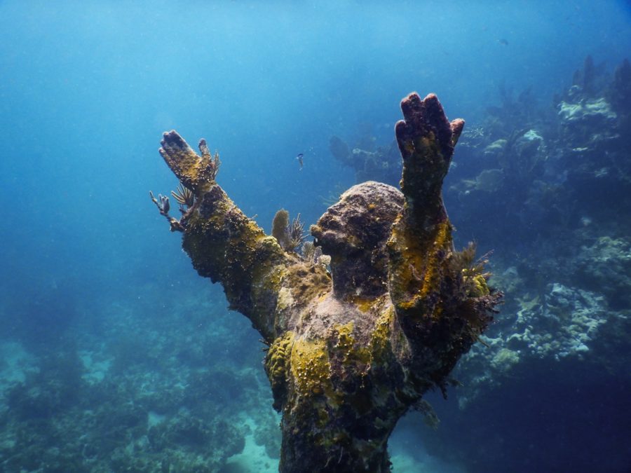
“All the lighthouses were exact to size. They were exact replicas of what’s out there,” Greenberg said. “The Christ (of the Abyss) statue was on there. I even had Elbow Lighthouse, which was destroyed by Irma.”
Greenberg and his wife sold the map at Pennekamp for $2, he recalled, “all rolled-up in a clear plastic tube and in a box.”
“It wasn’t cheap, but it wasn’t a helluva lot of money back then, either. Times were just different — gas was 19 cents, and the reefs were intact. There were no dive shops here, either,” Greenberg said.
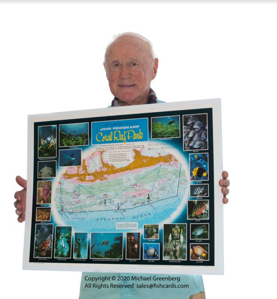
Greenberg eventually included some of his pictures along the side of the map, to showcase what people might expect to see when out using his map to explore the world below.
“You want to know what Molasses Reef looked like?,” he joked. “That’s what it used to look like, with huge brain coral and huge acropora palmata (Elkhorn coral). Big corals, mound corals. Everyone went there to dive to see this stuff!”
Greenberg also lamented how the coral had been over-collected over the decades for sale in souvenir shops, contributing to the decline of the reefs.
The map was integral for years for navigating the Upper Keys before eventually going out of print in the late 1970s or early ’80s, Greenperg proudly said. It’s been out of print since then — until now.
“This is the one time (the map’s) been back in print since,” Greenberg said, pointing to a copy of his original map being displayed at Sparky’s Sweet Treats, a new ice cream shop in Key Largo, whose owner is a friend of Greenberg.
Greenberg decided to put his original map back on display to the public as Pennekamp nears its 60th anniversary, to commemorate what the reef here has meant to him and his career. He hopes people will realize the immense history the reef has and how important it is for the future.
“I’m proud of everything I’ve done with my wife and my son. It’s what I live for,” he said.
When asked if he’d print additional copies, he noted that if there was interest, he’d be willing to explore the option.
“For now, there’s only one (map), and it’s at Sparky’s,” he joked. “If someone wants to see it, go get some nitrogen ice cream.”
For more information or to purchase a copy, email sales@fishcards.com.


