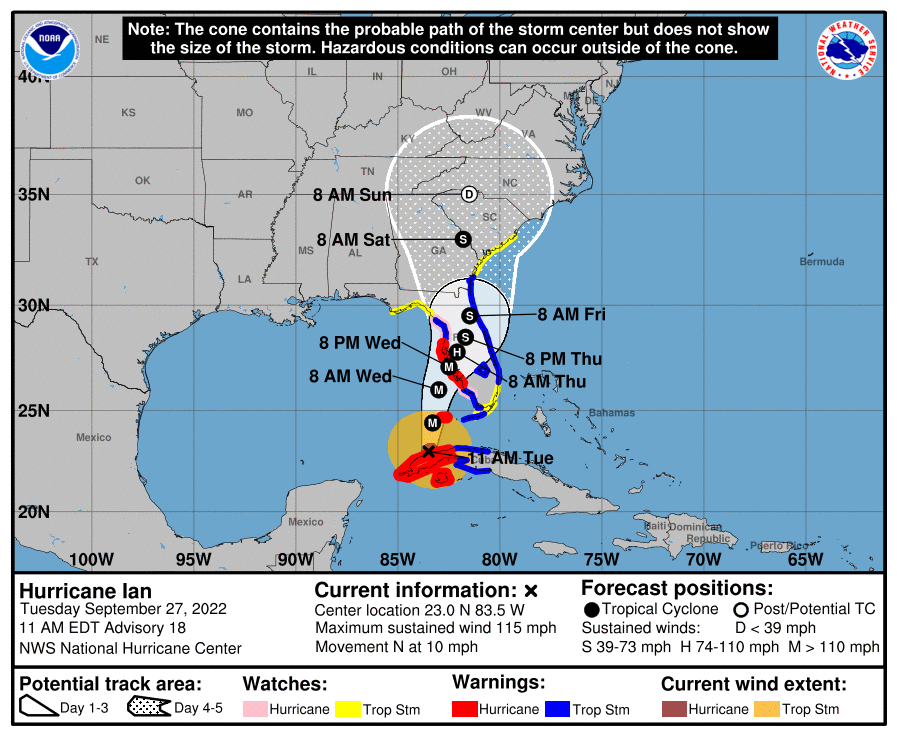
Florida Keys officials are ready and awaiting the tropical storm conditions that Hurricane Ian will send to the Lower Keys this afternoon and to the Middle Keys this evening. Potential storm surge flooding is expected on Wednesday, “AFTER the rain and wind subside,” said Jon Rizzo, forecast warning meteorologist for the National Weather Service.
Monroe County schools and county offices will be closed again tomorrow (Wednesday) given the likelihood of impassable roads due to surge flooding in several parts of the island chain.
“Whatever you saw with yesterday’s king tide, plan for 1 to 2 feet above that for the storm surge,” Rizzo said during the countywide storm coordination call at 9:30 a.m. Tuesday.
Sustained tropical storm-force winds, greater than 39 mph, are expected in Key West and the Lower Keys around 2 p.m. today and are likely in the Middle Keys this evening around 5 or 6 p.m. “Nasty” squalls could spawn tornadoes, so the entire Keys are under a tornado watch at least until 5 p.m. today, Rizzo said, adding that the tornado watch could linger into Wednesday.
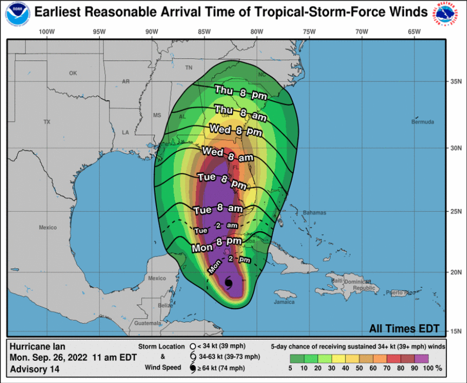
A tropical storm watch will likely be issued for the Upper Keys at 11 a.m. today, “as sort of an uncertainty watch,” Rizzo said. “Then, as the storm pivots to the east, we may hit the tropical storm warning button for the Upper Keys as well.”
Key West High School will open at noon today as a general population shelter. Key West officials and County Commissioner Jim Scholl on Monday strongly urged Shannon Weiner, the county’s emergency management director, to open a shelter, given their concerns about liveaboard boaters and homeless residents.
Low-lying areas, and those where the bay and ocean are particularly close to each, such as Matecumbe Key, Rizzo said, are the areas where surge flooding concerns him, along with areas of Sugarloaf Key, Little Torch, Big Pine, Stock Island, the entrance to Key West and parts of North and South Roosevelt boulevards.
