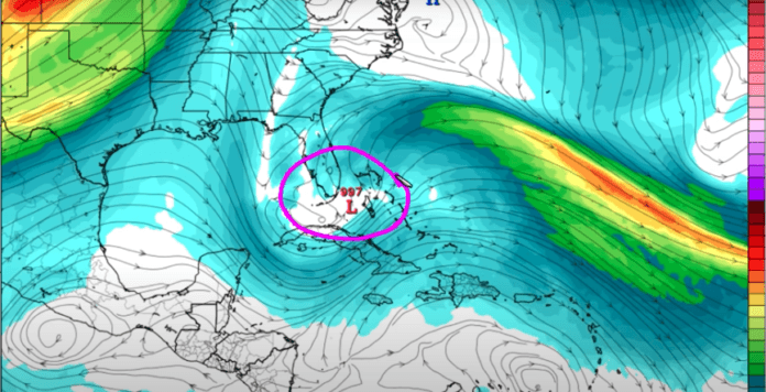
Nov. 5, 9:17 a.m. update: Tropical storm force winds may begin as early as the pre-dawn hours Sunday, but most likely late Sunday (close to midnight). Due to the slower forecast motion early next week, potential rainfall over the next 7 days could total 10 to 15 inches, with coastal flooding oceanside beginning late Sunday and possibly reaching 1 to 2 feet above mean higher high water (spring tide) levels early next week. Next update at 11 a.m.
Picture this: Tropical Storm Eta’s track is like a backward “s” — it leaves Honduras, crosses over Cuba and heads toward Florida. First it will move northeast and then it’s going to take a sweeping turn to the west.
“We don’t know when that turn takes place,” said Jon Rizzo, warning coordination meteorologist for the National Weather Service in Key West. He said if the turn happens when the majority of the storm is to the west of the Keys, it will be a relatively brief storm over the island chain. If the turn happens when the storm is to the east of the Keys, residents will have hours of heavy weather and more rainfall.
Rizzo said it’s unlikely that Tropical Storm Eta will reform with a defined core. “It’s going to be a sloppy, large, messy system. That means rather than sustained wind and rain, we might have squalls of rain and gusts of wind for localized wind damage, even the possibility of a tornado,” Rizzo said. Because of the unformed nature of the storm, Rizzo warns that the heaviest weather may not be located near its center.
In preparation, locals should secure loose objects in the yard and on decks. That includes Halloween decorations and campaign signs. Tropical force winds (39 to 73 mph) could arrive as early as late Saturday night, but most likely around dawn on Sunday morning.
The Weather Service is predicting between 5 and 12 inches of rainfall, and coastal flooding of up to a foot on the oceanside of the Keys.
Tropical Storm Eta is the 28th named storm in the Atlantic this season, tying the record for the number of named storms in a single season, set back in 2005. Eta jumped from a tropical storm to a category 4 in about 24 hours before landing on the Atlantic coast of Nicaragua and hooking over Honduras and back into the ocean.
Continue to monitor official sources such as the National Hurricane Center (nhc.noaa.gov) and news media such as the Keys Weekly newspaper (keysweekly.com) for more details in the coming days.


